These glorious photos show the city in days of old through to modern times. Have a look at these pictures to see how the city has changed:
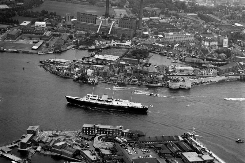
1. Portsmouth Harbour
Aerial view on the HMY Britannia sailing to Portsmouth Harbour, UK, 30th May 1965. (Photo by Daily Express/Hulton Archive/Getty Images) Photo: -
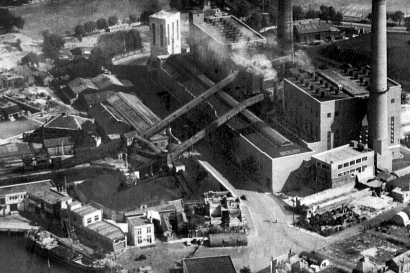
3. Old Portsmouth Power Station
Old Portsmouth Power Station circa 1948. To the bottom left is the Camber with the cola hoppers of Whites the coal merchant. Unloading at the wharf is a large collier with three barges alongside. At the pointed end of the coal wharves can just be seen the Bridge Tavern which is dwarfed by them. Above the Bridge Tavern is the lock for the coal barges that brought in coal for the power station. The covered travellators for taking the coal up and over Gunwharf Road can be seen. Above the lock are the buildings of HMS Vernon. To the bottom right can be seen Oyster Street which at this time passed into White Hart Lane and since these times a block of flats have been built over it. St Thomas Street passes behind the cathedral with many of the buildings just bomb sites. The bank now a residential building on the corner of Highbury Street can be Cleary seen. The east end of St Thomas's Street and Warblington Street leaading into St Georges Road close by Landport Gate are both bomb sites. To the top right hand corner can be seen the United Services cricket ground where, up until the Rose Bowl was built, Hampshire played first class cricket. Above the power station chimneys the railway line from the Harbour station to Portsmouth & Southsea High Level can be seen running along its tree lined route. Photo: -
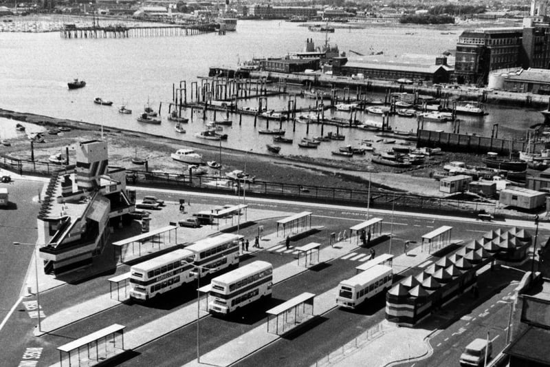
4. The bus station at The Hard
An aerial view of the bus station in The Hard, Portsmouth on June 8 1979 Photo: -