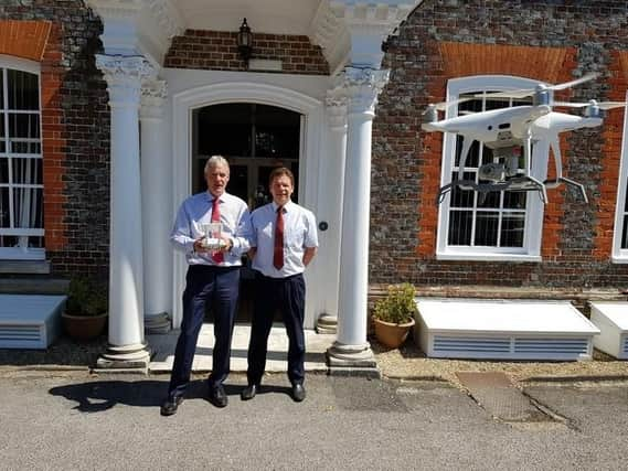
Surveyors are flying high with new drone licence


Daniells Harrison Chartered Surveyors have obtained a licence to use their drone for surveillance operations.
Business partners Chris Daniells and Richard Huffer recently attended a commercial UAV (unmanned aerial vehicle) flying course and have now been granted permission from the Civil Aviation Authority to fly the drone for commercial operations.Â
Advertisement
Hide AdAdvertisement
Hide AdRichard said: '˜The drone gives us the opportunity to easily survey previously inaccessible parts of buildings such as roofs and higher structural details.'
The CAA authorisation will enable the Fareham-based business to become one of the first chartered surveyors in the south of England to offer aerial drone surveys. The company believes the drone surveillance will benefit the customer in providing a more detailed inspection of property as well as being more cost effective.
The company's website states: '˜Aerial surveys are a cheaper and more efficient way of inspecting buildings that were previously only accessible by expensive lift platforms.
'˜We don't have to bring in cherry pickers which are costly and often hard to get on site. The high definition quality of the images and video really helps us to analyse the property in detail,' added Richard.
Advertisement
Hide AdAdvertisement
Hide AdThe company plans to use the drone alongside their existing services for residential and commercial properties. The drone will be used to help assess property valuations, building delapidation and construction defects. Aerial surveillance can also be used to support the process of planning applications.
Whilst potential customers can pay for aerial surveys, Chris Daniells believes his company offers the ideal package with footage being analysed first-hand by a qualified professional.
'˜With us you get the whole package because qualified RICS (Royal Institute for Chartered Surveyors)Â are piloting the drone. We know exactly what to look for and where issues are likely to arise,' explained Chris.
Chris and his fellow surveyors are certainly looking forward to putting their new gadget to use. '˜We're really excited to be offering this service to our clients. As you can imagine it is one aspect of our work that we will be fighting over to do,' added Chris.Â
Â