NOSTALGIA: This Portsmouth street hadn't changed in 60 years, then suddenly...


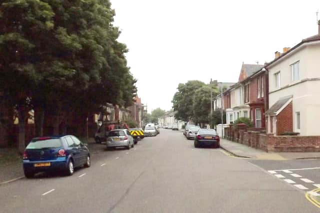
On the right is Pains Road with a gas lamp on the corner. Peeking over the rooftops on the right is St Peter's Church now King's Church, Portsmouth.
Behind the horse-drawn carts the road disappears around the bend to the staggered junction with Bradford Road and Blackfriars Road before passing over the railway line to Canal Walk and continuing to a junction with Somers Road North. I remember being a Saturday milk boy and helping the milkman in the early 1960s and this road looked exactly as it had 60 years before.
Advertisement
Hide AdAdvertisement
Hide AdToday the houses on the left have gone, as has the lamppost. The shop is now a home. Around the bend Somers Road is now blocked by Winston Churchill Avenue. It continues on the other side of the avenue to Canal Walk but after is blocked by Holbrook Road.
'¢The final picture shows a scene  many Portsmouth people still miss, the power station in Old Portsmouth.
Although it looks as if it is in a state of demolition it is in fact 1949 and the extension is being built, the new chimney would go to the right of  the one seen here.
The lock in the Camber was at this time disused and as can be seen private boats are moored within it.
Advertisement
Hide AdAdvertisement
Hide AdThe coal-fired power station was fuelled by coal brought in by colliers and barges and stored in massive heaps as can be seen near the top right hand corner.
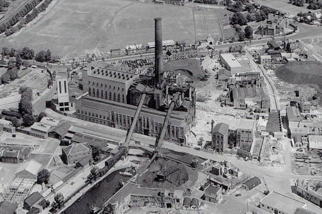
When completed the lock with a caisson would be used to bring the coal inward and the conveyors over Gunwharf Road would come into use.
In the top right corner can be seen the grammar school and in the crossroads can be seen, 13-years after they stopped running, tram tracks still in situ. Just to the right of centre is the Masonic Hall on the corner of what is now Highbury Street and King Charles Street.
To the right of the chimney in St George's Road can be seen Landport Gate, the only surviving gate in its original site into the old town.