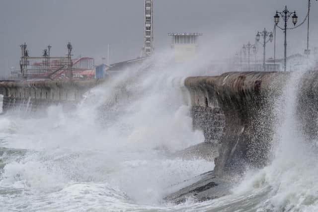
Portsmouth weather: Hour-by-hour forecast as Storm Gareth to batter city with 50mph winds and heavy rain over next 24 hours


The Met Office has issued a yellow weather warning for Portsmouth and across the Solent region from midday today until 3pm tomorrow.
With the forecaster warning that Storm Gareth, the seventh named storm of the winter, could cause travel disruptions on bus services and trains.
Advertisement
Hide AdAdvertisement
Hide AdIn a statement on it’s website, the Met Office warned: ‘Gusts of up to 50-55 mph are likely inland and 65 mph along western coasts.
‘Winds will gradually ease during Wednesday afternoon.’

Here’s what the hour-by-hour forecast for the next 24 hours says:
Portsmouth
Tuesday, March 12 forecast:
10am – Overcast – gusts of 46mph – highs of 9C
11am – Heavy rain – gusts of 51mph – highs of 9C
Midday – Heavy rain – gusts of 51mph – highs of 10C
1pm – Heavy rain – gusts of 35mph – highs of 8C
2pm – Heavy rain – gusts of 27mph – highs of 6C
3pm – Heavy rain – gusts of 27mph – highs of 6C
4pm – Light rain – gusts of 30mph – highs of 7C
5pm – Sunny intervals – gusts of 27mph – highs of 7C
6pm – Light rain shows – gusts of 30mph – highs of 7C
7pm – Clear night – gusts of 30mph – highs of 7C
8pm – Clear night – gusts of 34mph – highs of 6C
9pm – Clear night – gusts of 36mph – highs of 6C
10pm – Clear night – gusts of 37mph – highs of 6C
11pm – Clear night – gusts of 38mph – highs of 7C]
Wednesday, March 13 forecast:
Midnight – Clear night – gusts of 38mph – highs of 7C
1am – Clear night – gusts of 38mph – highs of 7C
2am – Clear night – gusts of 38mph – highs of 7C
3am – Clear night – gusts of 38mph – highs of 7C
4am – Cloudy– gusts of 37mph – highs of 7C
5am – Cloudy– gusts of 37mph – highs of 7C
6am – Cloudy– gusts of 36mph – highs of 7C
7am – Cloudy– gusts of 36mph – highs of 7C
8am – Sunny intervals – gusts of 36mph – highs of 7C
9am – Sunny intervals – gusts of 37mph – highs of 8C
10am – Sunny intervals – gusts of 41mph – highs of 9C
11am – Cloudy – gusts of 42mph – highs of 10C
Midday– Cloudy – gusts of 42mph – highs of 10C
1pm – Cloudy – gusts of 40mph – highs of 10C
2pm – Cloudy – gusts of 40mph – highs of 10C
3pm – Cloudy – gusts of 38mph – highs of 10C
What to expect as Storm Gareth blows in
Here’s what the Met Office is warning could happen as the storm hits over the next 24 hours:
- Probably some bus and train services affected, with some journeys taking longer
Advertisement
Hide AdAdvertisement
Hide Ad- Delays for high-sided vehicles on exposed routes and bridges likely
- Some short term loss of power and other services is possible
- It's likely that some coastal routes, sea fronts and coastal communities are affected by spray and/or large waves.