Portsmouth weather: Met Office issues weather warnings as 55mph gusts set to hit city


High winds are set to blow into our region from tonight until Saturday, with two separate yellow alerts being issued by forecasters.
The first weather warning comes into force at 10pm today and will remain in place until 9am tomorrow – with Portsmouth, Fareham, Gosport, Havant, Hayling Island and Waterlooville all covered by the alert.
Advertisement
Hide AdAdvertisement
Hide AdThe Met Office have also issued a second yellow weather warning for winds between 12pm on Friday and 6pm on Saturday.
With the forecasters predicting that the gusts of wind could reach as strong as 55mph over the coming days.
Here’s what the weather warnings say:
Wednesday to Thursday warning
On it’s website, the Met Office said: ‘A period of very strong and gusty winds is likely on Wednesday night and Thursday morning.
‘Strongest winds will be across South West England and South and West Wales late evening, with gusts of 60 to 70 mph on coasts and 50 to 60 mph inland.
Advertisement
Hide AdAdvertisement
Hide Ad‘Elsewhere winds will be strongest after midnight, with gusts of 60 mph on coasts and 50 mph inland before easing during Thursday morning.’

Friday to Saturday warning
The Met Office are warning that: ‘A deep area of low pressure is expected to track across northern Britain later on Friday and through early Saturday. Southwesterly winds will strengthen through Friday.
‘Gales will become widespread later on Friday, persisting well into Saturday whilst becoming more westerly.
‘Whilst some places may miss the worst of the winds, inland gusts of 50 mph are expected quite widely, with some places having gusts in excess of 60 mph, more especially across the north of the warning area on Saturday.
Advertisement
Hide AdAdvertisement
Hide Ad‘Gusts of up to 70 mph are likely around some coasts exposed to the west or southwest. Winds will gradually ease on Saturday, with the strongest winds becoming confined to Scotland on Saturday afternoon.
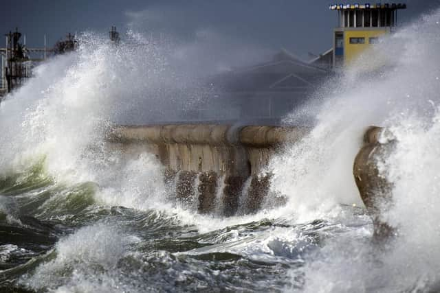
‘These winds will lead to large waves affecting coasts and the possibility of waves overtopping some coastal routes, especially in the west and south of the warning area.
‘In addition, bands of heavy rain sweeping eastwards on Friday in particular will present an additional hazard.’
What can residents expect?
- Some delays to road, rail, air and ferry transport are likely.
Advertisement
Hide AdAdvertisement
Hide Ad- Delays for high-sided vehicles on exposed routes and bridges likely.
- Some short term loss of power and other services is possible.
- It’s possible that some coastal routes, sea fronts and coastal communities could be affected by spray and/or large waves.
The Met Office is also forecasting that heavy rain will fall tonight and on Friday, coinciding with the wind warnings.