Travel disruption warnings as Storm Gareth to hit Portsmouth with 50mph winds and heavy rain


The Met Office has issued a yellow weather warning with residents being told to expect potential travel disruptions.
Storm Gareth, which is the seventh named storm of the winter, is set to hit Portsmouth and the surrounding area tomorrow and into Wednesday.

Advertisement
Hide AdAdvertisement
Hide AdAccording to the Met Office's current forecast gusts of up to 52mph will hit the city around lunchtime on Tuesday, with the strong winds continuing over the following 24 hours with max speeds of 46mph on Wednesday.
Heavy rain is also being predicted for across our area between 12pm and 5pm tomorrow.
The weather warning is in place between 9pm tomorrow and 3pm on Wednesday.
In a statement on its website, the Met Office says: ‘A spell of strong northwesterly winds is expected to develop across southwest Scotland late on Tuesday evening then extend across much of England and Wales through Wednesday.
Advertisement
Hide AdAdvertisement
Hide Ad‘Gusts of up to 50-55 mph are likely inland and 65 mph along western coasts.
‘Winds will gradually ease during the afternoon.’
The Met Office are also warning that Storm Gareth could cause travel disruption this week.
With commuters being told to expect:
- Probably some bus and train services affected, with some journeys taking longer
- Delays for high-sided vehicles on exposed routes and bridges likely
Advertisement
Hide AdAdvertisement
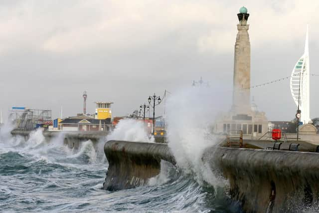
Hide AdWhile forecasters have also been warned that there could be some ‘short term’ power losses and that spray and/ or large waves could affect coastal communities and sea fronts.
The storm was officially named by the Irish Meteorological Service this morning, the Met Office has announced.
Storm Gareth will be the second storm to hit the Portsmouth area in March following Storm Freya which brought heavy rain and winds at the start of the month.