NOSTALGIA: British moat swamped at Portchester Castle: rising sea levels are nothing new...


Quite simple Frank: it was only a proposed route made in 1884-85 by the Portsmouth Street Tramways Company.
The horse tramway was to run from Cosham railway gates along High Street, east down Magdala Road and then north along Park Lane to Havant Road.
Advertisement
Hide AdAdvertisement
Hide AdThe plan was to then run the service north-east cross Widley Lane and proceed across Portsdown Hill to the George Inn on the summit.
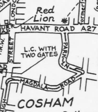
In the end the company ran three-horse buses from Cosham to Waterlooville along London Road.
For a tram route that stopped running in 1935 I have never known such interest in photographs I have published and editorial I have written. Thank you all who have dropped me e-mails saying how fascinating you found it.
The map and information come from SE Harrrison’s marvellous book The Tramways of Portsmouth as well as Barry Cox’s photographs and postcards.
I shall publish more in coming weeks.
Advertisement
Hide AdAdvertisement
Hide Ad•Ted Saunders, of Portchester, has kindly sent me many engravings made by Lt-Col JH Cooke of Portchester Castle which I shall also include during the coming weeks.
The ever popular castle and grounds are as big a draw today as they ever were.
In this drawing we see a plan of the castle as it looked in Roman times.
We can see that the British moat to the south once extended on to land that has since been reclaimed by the sea.
Advertisement
Hide AdAdvertisement
Hide AdThe Roman moat was dug close to the wall and can be seen to this day.
The entire structure was called a castrum, the Roman word for a large legionary fortress.
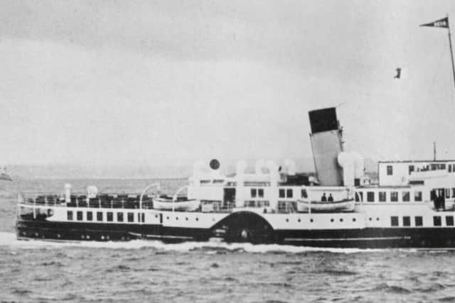
•The picture of the paddle steamer harks back to the days when crossing the Solent was an adventure in itself.
If you buy a ticket to Ryde these days and opt to go over by hovercraft or catamaran, the trip’s finished in a matter of minutes.
Advertisement
Hide AdAdvertisement
Hide AdThis was the paddle steamer Ryde and if you had travelled from London by train to get to the island then a nice cup of tea was in the offing on board this most civilised of vessels.
Ryde had the capacity to take 1,000 passengers so imagine how many cups of tea were served during the 40-minute crossing.
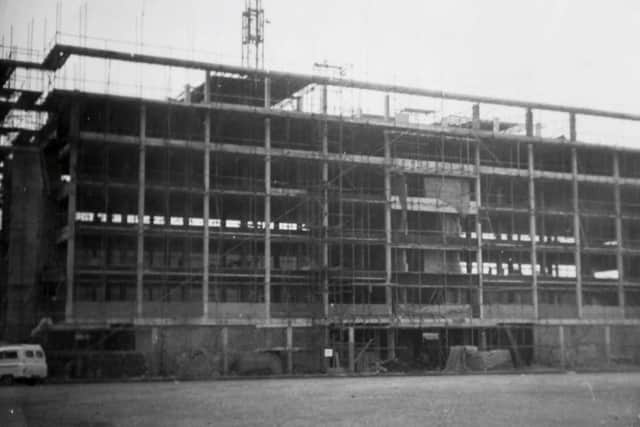
•I am glad to say that my colleague Barry Cox didn’t just take transport photographs.
In 1962/63 he took this photograph of what was to become in later life Chandos Rise a large residential block in Buckingham Street, Landport.
The building under construction was to be known as CJB House (CJB were the initials of the marine engineering firm Constructors John Brown) who occupied it.