A towering old view of Fratton Road and its ‘green’ tramlines | Nostalgia


On the left is the Portsmouth Junior Technical School which, in our time as it were, became the home to the much-missed Radio Victory.
Next along is the Museum Gardens pub then the junction of Gunner Street then the police station with living quarters above.
Advertisement
Hide AdAdvertisement
Hide AdThe street running at an angle in the top left corner is Terwick Street with Kilmeston Street crossing left and right. On the right side was the Rehoboth Baptist Chapel, a name which dates from the Old Testament.
On the corner of St Mary ’s Road, bottom right, can be seen M Filer & Son who were tailors.
Along Fratton Road can be seen the tracks of the pollutant- free tram cars to be followed by pollutant-free trolleybuses. Did the transport authorities of the time know something we didn’t?
A very atmospheric photograph of an area of Portsmouth that has long since disappeared. We can appreciate how much damage was done during the blitz because of the tightly-packed streets and houses.
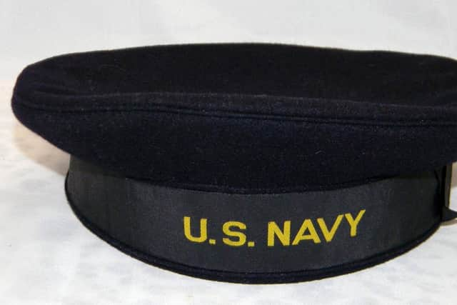
Cartoon capers put paid to navy hat
Advertisement
Hide AdAdvertisement
Hide AdLast week I published a photograph of American sailor John Malloy and wondered why he was wearing what I thought was a Royal Navy ratings’ cap. Wrong.
Richard Boryer tells me: ‘Walt Disney made a Donald Duck cartoon with the duck wearing a naval uniform with the cap and it became known as a Donald Duck cap. It did not go down well with the US Admiralty so they changed it to the white cap so well-known today.’
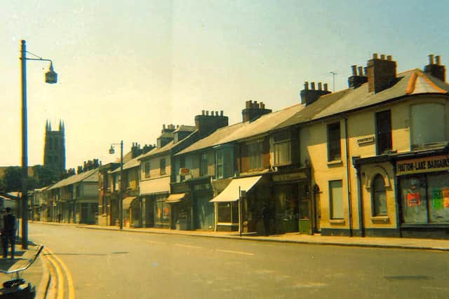
Deserted Fratton Road in the 1960s
This picture shows the reverse of the above picture, looking south down Fratton Road I guess about the middle to late 1960s. With the lack of traffic it might be a Sunday.
On the right was Fratton Lake Bargains, an early Pound Store I would guess. On the distant right is the Kilmeston Street or Gunner Street junction. The cycle on the left has, the then modern, cowhorn handlebars.
Comment Guidelines
National World encourages reader discussion on our stories. User feedback, insights and back-and-forth exchanges add a rich layer of context to reporting. Please review our Community Guidelines before commenting.