Portsmouth’s hidden second rail network - with 23 miles of its own track | Nostalgia


The whole system was self-contained with its own locomotives, engine sheds and staff mess rooms.
As you can see, every dry dock and sea lock was accessed by the railway. There was even track across the caissons, the movable gates that held the water back from the locks.
Advertisement
Hide AdAdvertisement
Hide AdI am not too sure who worked the facing points but I am assuming it was the locomotives’ firemen. Trailing points would be pushed over as the loco passed over them.
There were two entrances to the dockyard from the main British Railways line. One was from Portsmouth Harbour via a viaduct across the mudflats to South Railway Jetty. This was taken out of use in 1941 when the swing bridge on to the jetty was bombed.
The other, more well-known one was the dockyard branch line. This left the main line adjacent to the up platforms of the High Level at Portsmouth & Southsea station. It was used until the line’s end in 1981.
As can be seen in the bottom right hand corner, the line crossed Edinburgh Road and Alfred Road by level crossings and then entered the dockyard crossing Flathouse Road via a gate alongside Unicorn Gate.
Advertisement
Hide AdAdvertisement
Hide AdFlathouse Road was a public right of way from Lennox Road to what is now Trafalgar Gate, now the main gate of the naval base. The former main gate at The Hard is now called Victory Gate much to the chagrin of many ex-dockyard men I have spoken to.
At the end of the jetty in Basin No3 is where the massive 240-ton crane once stood. It could be seen for miles around until it was demolished in 1984.
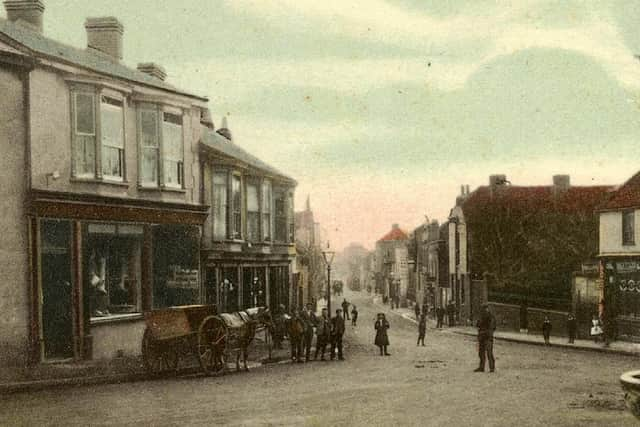
• The Edwardian view down High Street, Cosham, would have, at one time, been the road to Southampton. Before Spur Road was built on the right, the main road went down High Street for 200 yards and then turned right along what is now Waite Street and then Medina Road joining what is now Southampton Road by the railway bridge. I wonder if the young men on the left went off to France in the First World War never to return?
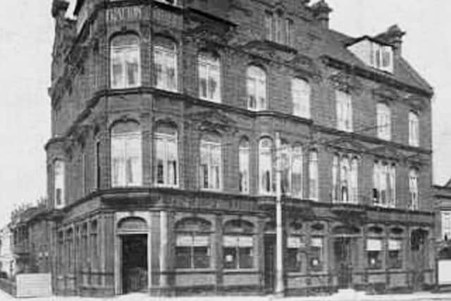
•The imposing Fratton Hotel was perfectly placed for passengers arriving at Fratton. It stood just north of Fratton bridge on the corner of Sydenham Terrace, on the left. Behind the camera is Selbourne Terrace leading to the station.
Advertisement
Hide AdAdvertisement
Hide AdOn the left Fratton Road passes over Fratton Bridge and then divided into Goldsmith Avenue, Fawcett Road and Victoria Road North. Was there a bell under the canopy on top of the roof? After the hotel was demolished, the new building became a restaurant and later, as I recall, a Black Cat cafe.
Comment Guidelines
National World encourages reader discussion on our stories. User feedback, insights and back-and-forth exchanges add a rich layer of context to reporting. Please review our Community Guidelines before commenting.