Portsmouth street traders organised day trip by chara for city children '“ nostalgia


As luck would have it Tony Davis, who provided me with the original photograph, had another wide angle photograph of the event and, as can be seen, it was taken outside the Empire public house on the corner of Somers Road North and Besant Road, Fratton.
Look at the first picture and you will see the warehouse door on the left is the same door as in the original photo.
Advertisement
Hide AdAdvertisement
Hide AdThe Portsmouth Street Traders' Association, which organised the day out, have their banner on display. Does anyone know what happened to it?
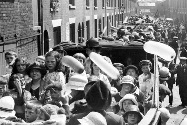
I believe the man with a cross marked under his feet is Councillor Charles Brown who put his own money towards the event. What wonderful occasions these must have been.
The Portsmouth Lost Pubs website tells us the Empire Tavern was originally the Builders Arms and renamed the Empire Tavern in 1891.
It latterly became a Brickwood's establishment until 1967 when it closed and was demolished.
Does anyone remember drinking in the pub?
Advertisement
Hide AdAdvertisement
Hide Ad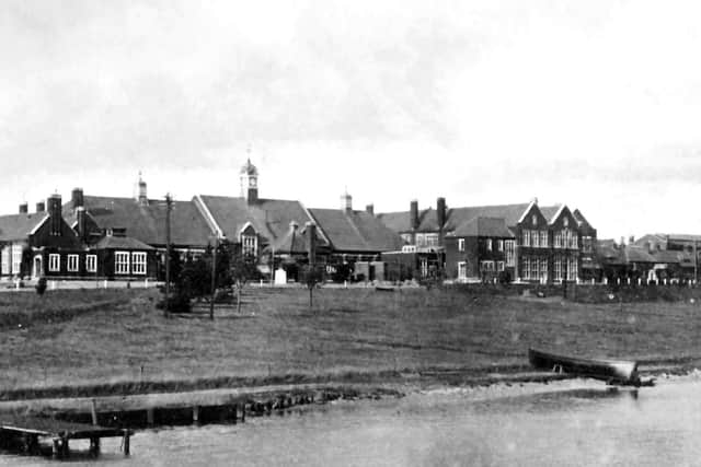
'¢Â The third picture is a shot of HMS Excellent taken from the Portsea Island shoreline. It shows the eastern edge of Whale Island with some of the original buildings at the home of the gunnery school HMS Excellent after 1864 when the first house was built. The causeway and bridge to the island are out of view. Many of the buildings have since been demolished.
'¢And so, to the final picture today showing aircraft in the south-western corner of Portsmouth Airfield as it was in 1945. Below them is Airport Service Road and to the left of that the railway line. Can anyone identify the aircraft and tell me why they were positioned where they are?
Portsmouth's first plans for an airport were for a three-part scheme of a seaplane base in Langstone Harbour, a municipal airport on Farlington Marshes and an international airport on Portsea Island. This idea dated from 1924 but never materialised although the marine airport was still being discussed in November 1937.
At the end of 1930 work started on a 276-acre site on Portsea Island. This would become a conventional airport. Within a month of work starting,the first aircraft to use the site landed.This was Avian IVM G-AAWH, piloted by Flying Officer Al Mortimer who landed on December 14, 1930.On July 2, 1932, the airport was opened with a flying display watched by more than 50,000 people.
Thanks to Portsmouth Library's History Centre for use of the photo.