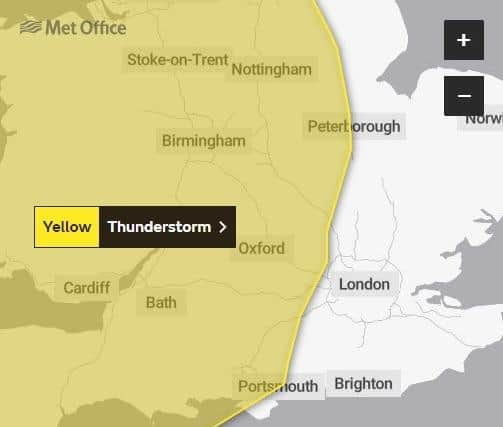
Thunderstorms yellow weather warning issued over Waterlooville, Fareham and parts of Hampshire by Met Office with chance of 'heavy rain'
and live on Freeview channel 276
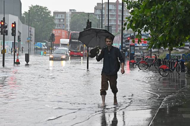
In contrast to the heatwave and current arid conditions, the Met Office predicts Fareham, Waterlooville, and other parts of Hampshire will be hit by thundery deluges.
The forecaster said some places will stay dry while others will experience heavy rain, on Monday.


Advertisement
Hide AdAdvertisement
Hide Ad‘Whilst some places will avoid them, thunderstorms are likely to develop increasingly widely as we go through Monday,’ the Met Office said.
‘Storms will probably already be underway for Northern Ireland and parts of Scotland by early Monday, before also developing across parts of England and Wales by late morning and into the afternoon. Storms should begin to ease from the west later.
‘Very locally 20-30 mm of rain is possible in an hour, and up to around 50 mm in three to six hours. Hail and frequent lightning are also possible.’
The weather warning will be in place from 6am to midnight.
Disruption is also likely due to the storms, according to the forecaster.
Advertisement
Hide AdAdvertisement
Hide AdThe Met Office added: ‘There is a small chance that homes and businesses could be flooded quickly, with damage to some buildings from floodwater, lightning strikes, hail or strong winds.
‘Where flooding or lightning strikes occur, there is a chance of delays and some cancellations to train and bus services.
‘Spray and sudden flooding could lead to difficult driving conditions and some road closures.
‘There is a slight chance that power cuts could occur and other services to some homes and businesses could be lost.’