Work rest and play at HMS Vernon, Portsmouth '“Â Nostalgia


In its time it was of course one of the most important Royal Navy establishments.
In this plan from 1930 we see where much of the experimental work was carried out but more than that, just look at the recreational facilities that were available to those based there.
Advertisement
Hide AdAdvertisement
Hide AdAt the top of the map can be seen warrant officers and wardroom tennis courts. Below that is the football and sports ground.
To the lower left of that are the men's and chief and petty officers' tennis courts. Above that is the billiard room.
Alongside Gunwharf Road are squash courts. It appears that although much work in instruction and lectures took place there was always room for play.
n When the Co-op superstore opened in Hulbert Road (now ASDA), the Co-op closed many of its much-loved small local stores.
Advertisement
Hide AdAdvertisement
Hide AdHere we see the food hall and separate butchers shop along Bedhampton Road at the junction with Lester Avenue perhaps in the late 1970s or early 1980s. The decimal half pence was taken out of circulation in 1984. Here a small loaf cost 33.5p.
To the far left is Smee's off-licence which it still basicallythe same although under new management.
The butchers is now a funeral parlour and the food hall a fish and chip shop. On the far left is a rarity these days '“Â a phone box.
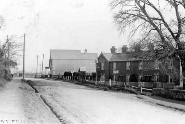
'¢Â I wonder if any long-term residents of Drayton, Portsmouth, can let me know where I am looking in this postcard view along Havant Road?
Advertisement
Hide AdAdvertisement
Hide AdI want to take a '˜today' shot but when I arrived at what I thought was the right spot, I couldn't make out the building in the distance.
I am sure that the houses on the right have been demolished and a parade of shops built on their site.
Is that Lower Drayton Lane on the right?
Â