Portsmouth's friendly policeman at the busy junction


Here he is again, above, seeing another two children safely across Commercial Road.
Just how dangerous this location was can be seen by the loaded waggonette turning sharply to its left from Edinburgh Road. The passengers are dockyard men and it is dinnertime '“ lunch today, of course.The waggonette is carrying the men to Arundel Street.Â
Advertisement
Hide AdAdvertisement
Hide AdThe gentleman on the right is riding what used to be called a sit-up-an-beg cycle and he is complete with cycle clips, yet another rarely seen item on cyclists today.Â
Â
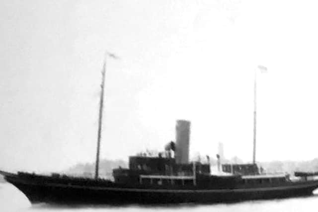
Belowis another photo sent to me by Jocelyn Booth of a yacht leaving Portsmouth Harbour on June 24 during for the 1911 Coronation Fleet Review.
She appears to be flying ensigns from the mastheads. Can any of you ship-spotters tell me more about the vessel please?
Â
What is now the featureless Milton Common in the triangle between the Eastern Road, Moorings Way and the sea wall was once Milton Lake.
Advertisement
Hide AdAdvertisement
Hide AdWhen the tide ebbed it was a large muddy pond but when the tide returned it could be a beautiful lake.
Alongside the western edge of the lake, which ran adjacent to the Eastern Road, there were once many houseboats moored.
I say houseboats but, as many will remember, they were all types of craft '“ many ex-naval patrol and torpedo boats, plus many other large craft.
They were a legend in their time and residents living in the peace and quiet after the war were a romantic sight to people passing along the Eastern Road at night.Â
Advertisement
Hide AdAdvertisement
Hide AdMany of the '˜boats' were acquired for somewhere to live as there was little housing to be had in the city after the blitz of the war.
By the mid 1960s the boats had become a health hazard and one by one they were towed away. In 1966 the city council decided to landfill the lake to become a common.
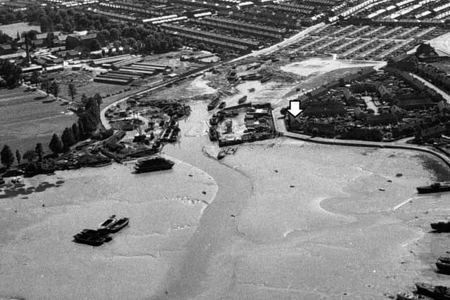
John Rich lived on Shore Avenue, marked with an arrow in the aerial photo, below. Warren Avenue came to an end by the poplar trees on the left but the field is now all covered in housing.
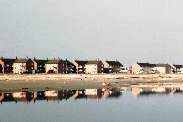
In the top left hand corner are the buildings of the soon-to-be-demolished St James' Hospital. In the photograph, below, we see the flats alongside the Eastern Road for Milton Lake and the shoreline where the houseboats were once moored.
 I should think this photo was taken shortly before the  lake was landfilled. To the far right of the end flats is Sword Sands Road.Â
  Â