Weather warning for thuderstorms issued for Portsmouth and Hampshire by the Met Office
and live on Freeview channel 276
The forecaster has issued the alert for thunderstorms covering south-west Hampshire, including the Portsmouth area, Southampton, Isle of Wight and Winchester from 12pm to 10pm on Monday.
It comes just hours after the Met Office issued a yellow warning for wet weather, which is expected to remain in force across the region until 7am tomorrow.
Advertisement
Hide AdAdvertisement
Hide AdAccording to the forecaster, following clearance of overnight heavy rain, there is potential for thundery downpours to develop across parts of southern England on Monday afternoon, lasting into the evening.
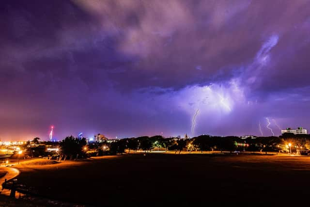


Many places will miss the worst of the weather, but scattered torrential thundery downpours may bring some impacts, such as flooded roads.
Spray and sudden flooding could lead to difficult driving conditions and some road closures, the Met Office warned.
There is a small chance that homes and businesses could be flooded quickly, with damage to some buildings from floodwater, lightning strikes, hail or strong winds
Advertisement
Hide AdAdvertisement
Hide AdThere is also a small chance of fast-flowing or deep floodwater.
And where flooding or lightning strikes occur, there is a chance of delays and some cancellations to train and bus services
There is a slight chance that power cuts could occur and other services to some homes and businesses could be lost.
A message from the Editor, Mark Waldron
You can subscribe here for unlimited access to our online coverage, including Pompey, with 70 per cent fewer adverts for less than 20p a day.
Comment Guidelines
National World encourages reader discussion on our stories. User feedback, insights and back-and-forth exchanges add a rich layer of context to reporting. Please review our Community Guidelines before commenting.