
Take a stroll along this stunning 22-mile Hampshire coastal path which takes in sea views and historic sites
A new 22-mile section of the King Charles III England Coast Path (KCIIIECP) between Portsmouth and Hayling Island along the scenic south coast has opened to the public - boasting both sea and historical views.
Starting from Old Portsmouth and ending at the beach at South Hayling, the path is part of the KCIIIECP which , when complete, will be the longest managed coastal walking route in the world and the UK’s longest National Trail.
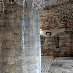
Setting out next to the 15th century Round Tower, built to protect the harbour from French invasion, the path continues along the city walls and into Southsea - at the moment including the temporary path for the sea defences - with highlights including Southsea Castle, built by Henry VIII, the Victorian South Parade Pier, Canoe Lake and Southsea Model Village.

Rounding Eastney Point marks the entrance to Langstone Harbour which sees a transition from an urban environment to natural estuarine habitats.
After following the east coast of Portsea Island, the route reaches Farlington Marshes Nature Reserve, home to thousands of birds, especially over-wintering brent geese, avocets, redshanks and ringed plovers and then Southmoor Nature Reserve at Broadmarsh with both reserves owned by the Hampshire & Isle of Wight Wildlife Trust.
.jpeg?trim=0,0,0,0&width=640&quality=65)
The sea wall was breached by the sea at Southmoor Nature Reserve six years ago and what was once coastal grazing marsh has transformed into saltmarsh attracting a new variety of wetland species. Natural England has funded a £500,000 boardwalk here to improve access, and a boardwalk, made from recycled materials, will eventually be 400m long after the final 100m is installed over the winter.
The route then crosses Langstone Bridge onto Hayling Island, immediately passing the old oyster bed lagoons and following the Hayling Billy Trail down to the southwest corner of Hayling Island.
Here the path passes by The Kench, a saltmarsh and tidal inlet of Langstone Harbour of special importance as a sheltered feeding area for birds. The route culminates on Hayling Island beach after passing by Gunner Point, home to Hampshire’s most extensive sand dune system which supports rare plant species and ground-nesting birds.
Throughout the path, Bird Aware Solent has contributed to the design of 19 interpretation panels highlighting the importance of bird awareness and sensitivity to nature. This stretch of the path largely follows the existing Waterside Walk, a popular local 14-mile path promoted by Langstone Harbour Board.
While establishing the new trail, Natural England has sought to improve the alignment of the coast path bringing in legal provision for the trail to ‘roll back’ in response to coastal erosion, thereby securing people’s rights into the future and protecting the investment being made now.
In particular, at Southmoor Nature Reserve the route has been pushed back to avoid inaccessible areas and those which can become flooded due to the breached sea wall.
Graham Horton of Natural England said: “We’re thrilled to open this new section of the King Charles III England Coast Path, more than 22 miles of spectacular views boasting some of our region’s most iconic wildlife and landscape. It will provide both the local community and visitors from further afield more opportunities to access the coast and connect with nature.”
Key information
- Just over 22 miles of footpath from Portsmouth to South Hayling is now open
- Improvements include 400m boardwalk in Southmoor Nature Reserve
- New provision for the path to be easily moved following coastal erosion

Councillor Kirsty North, Hampshire County Council’s Cabinet Lead for Universal Services, said: “This new stretch of the King Charles III England Coast Path is more than just a walking route – it’s a journey through Hampshire’s heritage, habitats and coastline. Whether you’re a seasoned hiker or a family out for a weekend stroll, this path offers something special for everyone. We’re proud to support a project that not only opens up access to nature but also protects it for future generations.”
Councillor Peter Candlish, Cabinet Member for Transport at Portsmouth City Council, said: "The opening of the Portsmouth section of the King Charles III England Coast Path is a fantastic milestone for our city. This new stretch not only celebrates our rich naval and maritime heritage and stunning coastal views, but also improves access for residents and visitors.
“We want to make it easier for everyone to enjoy walking and connecting with nature. We’re proud to play a part in this historic national trail that brings people closer to the sea and showcases the beauty of Portsmouth’s waterfront."
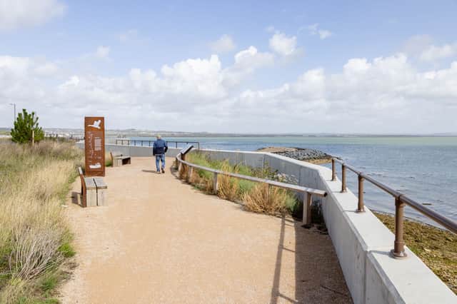
The trail along the coastline of Portsmouth and Southsea and then around Langstone Harbour is generally flat, following public footpaths, promenades and highway pavements, but includes some shingle beaches. Some of the footpaths through Langstone Harbour can become wet and muddy in winter.
The KCIIIECP is a National Trail around the entire coast of England. Existing coastal national trails and other regional walks make up parts of the KCIIIECP and this newly improved stretch in Hampshire forms part of it.
You can plan your walk on the KCIIIECP by visiting the National Trails website.